

GeoBridge
Software, die Brücken baut
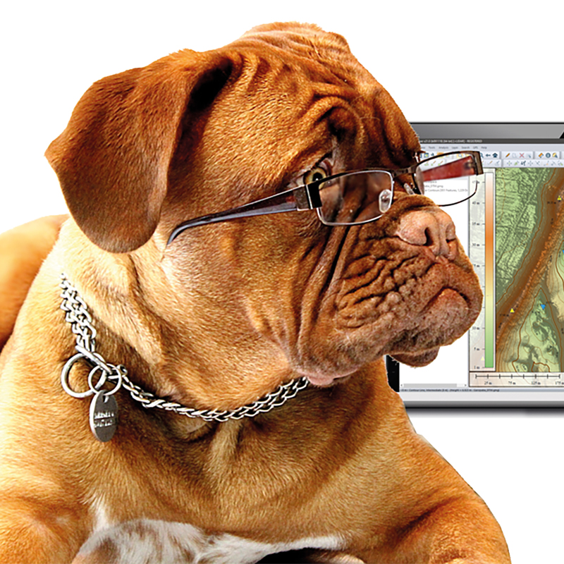
Global Mapper - das Desktop-GIS ist nicht nur aufgrund der zahlreichen Geoformate, die die Software lesen und schreiben kann, ein Brückenbauer. Die umfassende Funktionalität und die einfache Bedienung bieten auch Einsteigern den idealen Zugang zur GIS-Welt.
Avenza Software - die echte Brücke zwischen GIS und Grafik. Durch die Geo-Erweiterung der Adobe-Produkte Illustrator und Photoshop eröffnen sich auch den nicht-Geo-Fachleuten völlig neue Möglichkeiten.
Software die wir lieben
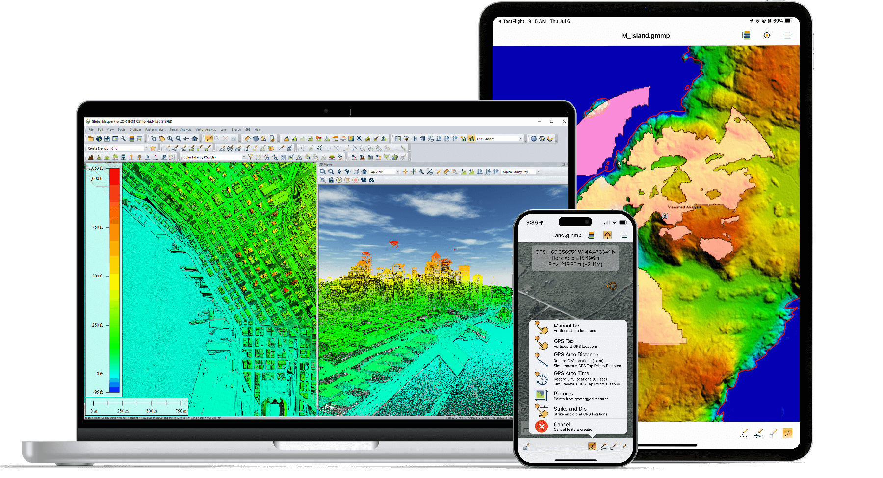
Das umfassende Desktop-GIS
Die Global-Mapper-Suite bietet alles, was Sie brauchen:
- Global Mapper Standard - umfassend, bewährt und zuverlässig im Einsatz rund um den Globus
- Global Mapper Pro - mit umfassendem Support von LiDAR-Daten
- Global Mapper Mobile - der »verlängerte Arm« der Desktop-Version in das Gelände
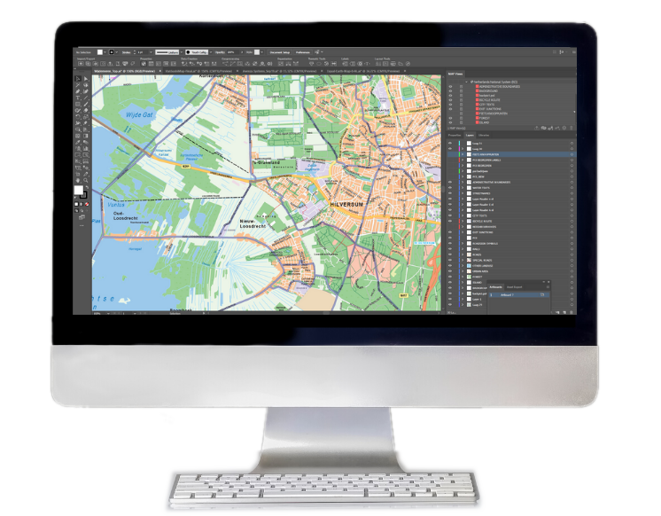
Erstellen von Karten mit Geodaten in Adobe Illustrator
MAPublisher integriert mehr als fünfzig GIS-Kartenwerkzeuge nahtlos in Adobe Illustrator und unterstützt Sie bei der Erstellung schöner Karten.
Importieren Sie branchenübliche GIS-Datenformate und erstellen Sie in der Design-Umgebung von Adobe Illustrator gestochen scharfe Karten - mit allen Attributen und Georeferenzen.
MAPublisher für Adobe Illustrator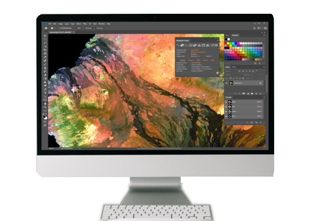
Geodaten in Adobe Photoshop
Die Software Geographic Imager erweitert Adobe Photoshop, um die Arbeit mit räumlichen Bildern schnell und effizient zu gestalten. Sie bietet Werkzeuge zum Importieren, Bearbeiten, Manipulieren und Exportieren von Geodaten wie Luft- und Satellitenbildern.
Nutzen Sie die nativen Adobe Photoshop-Funktionen wie Transparenzen, Filter, Pixelbearbeitung und Bildanpassungen wie Helligkeit, Kontrast und Kurvensteuerung, ohne den räumlichen Bezug zu verlieren.
Geographic Imager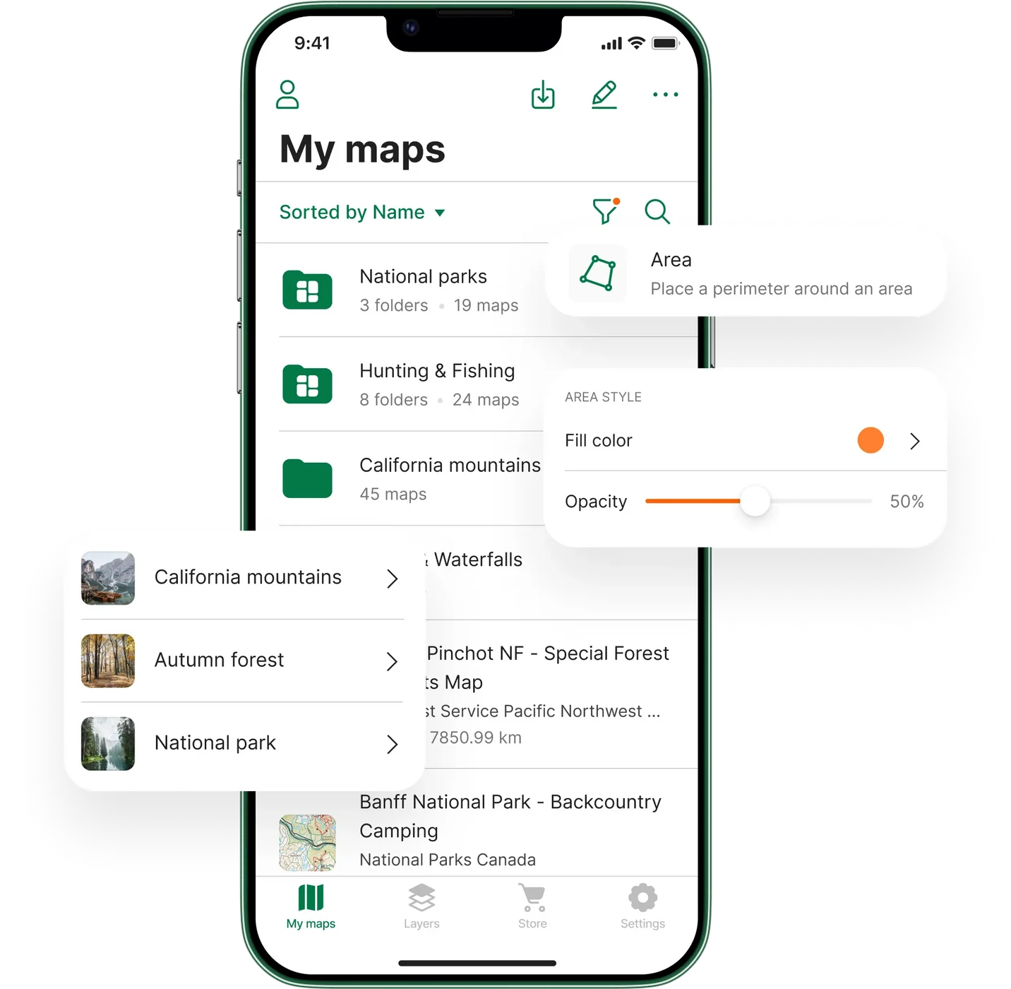
Mehr als 1 Million Karten für Ihr mobiles Gerät
Ob bei der Arbeit oder in der Freizeit - wenn Sie Avenza Maps auf Ihren mobilen Geräten installiert haben, finden Sie sich auch ohne Internet oder Netzwerkverbindung zurecht.
Neben der Standard-Version für Freizeitaktivitäten ist besonders Avenza Maps Pro interessant: mobile Offline-Kartierung und Datenerfassung für Fachleute in allen Bereichen - mit Ihren Karten, mit Ihren Daten.
Avenza Maps ProInformationen


Beiträge rund um die Software
Im Bereich "Know-how" finden Sie zahlreiche Beiträge, die verschiedenste Aspekte der Software behandeln - Wissenswertes, Tipps & Tricks, How-to und mehr.
Unter "Blog" zeigen wir, wie die Software in verschiedensten Anwendungen eingesetzt wird. Eine Quelle der Information und Inspiration.
ThemenübersichtOnline-Shopangebot
Nutzen Sie unseren Shop, um sich über die verschiedenen Lizenzmodelle zu informieren, eine Übersicht der aktuellen Preise zu erhalten oder direkt zu bestellen.
Gerne senden wir Ihnen jederzeit ein individuelles Angebot zu oder beantworten Ihre Fragen per E-Mail oder direkt am Telefon.
Zum Shop
Training und Workshop
Für Global Mapper finden regelmäßig Online-Trainings statt. Die aktuellen Termine sowie das Trainingsprogramm erfahren Sie auf unserer Trainings-Seite.
Darüberhinaus bieten wir individuelle Kurse direkt bei Ihnen oder auch Workshops rund um alle von uns angebotenen Software. Fragen Sie uns für ein individuelles Angebot.
Global Mapper TrainingWissenswertes rund um unsere Software
Sie besitzen bereits unsere angebotene Software? Dann finden Sie hier die wichtigsten Antworten auf unseren Service-Seiten:
- Software-Download: Wo und wie können Sie die Software laden
- Wissensbasis: Wo und wie erfahren Sie mehr zur Software
- Lizenzierung/Registrierung: Wie und wo?
- Lizenzbestimmungen